Maps Exhibit

A map of the world, from a 1587 edition of Abraham Ortelius’ “Theatrum Orbis Terrarum." This original map and others will be on display as part of the exhibit, Where Do We Go From Here? Maps and Atlases from the Duncan Payne and Lehigh Libraries Collectionswill open Aug. 21 and continue through the Fall 2023 semester.

A Love of Maps and a Legacy

A new exhibit in Linderman Library will include maps dating back to the 16th through 18th centuries.

Story by

Christina Tatu

Photography by

Christa Neu

Duncan MacRae Payne ’63, an international relations major, loved traveling and history– passions he merged by collecting maps, particularly those dating to the 16th through 18th centuries.

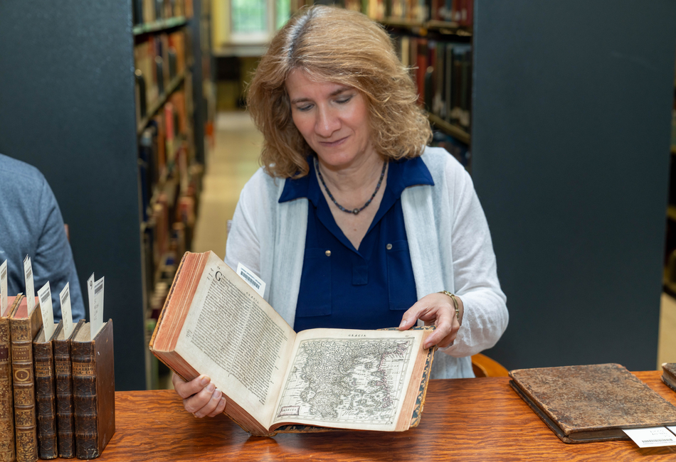
When Payne died in August 2021, he bequeathed some of his most important atlases to Lehigh University Libraries Special Collections. Those atlases will be on public display for the first time as part of an exhibit of maps in Linderman Library. Where Do We Go From Here? Maps and Atlases from the Duncan Payne and Lehigh Libraries Collectionswill open Aug. 21 and continue through the Fall 2023 semester.

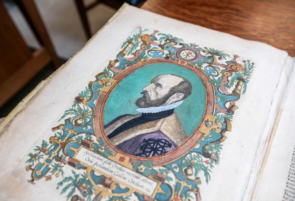
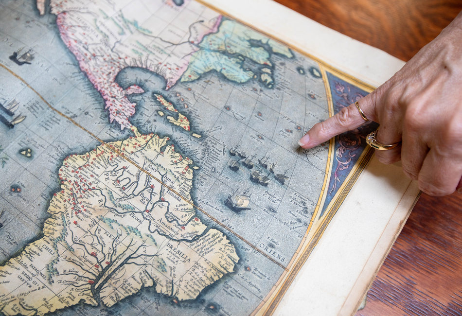
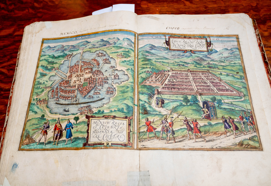
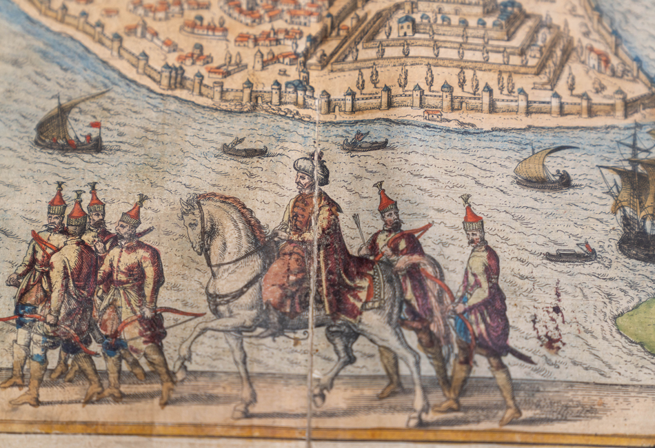
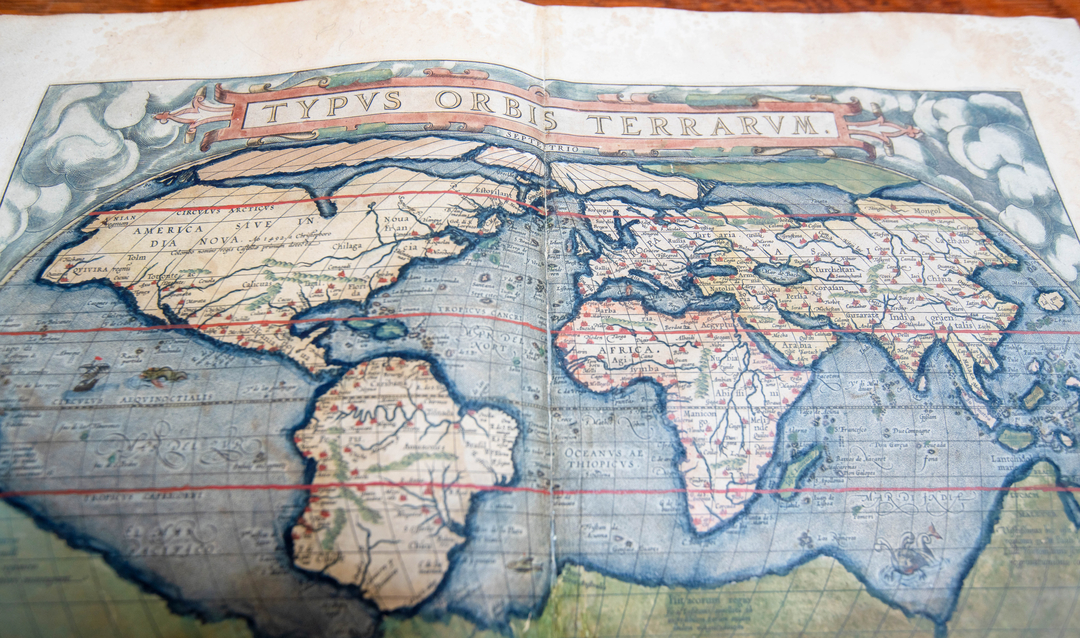
The intricate hand-colored maps, some dating back to 1575, depict the geography of the world at the time, as well as reveal the politics, social norms and even the mythology people believed in.

“Maps were so important and near and dear to him, and so was Lehigh,” said Payne’s daughter Eliane Dotson, co-owner of Old World Auctions in Richmond, Virginia. “He wanted Lehigh to be able to start an amazing collection as well as for the students there to have access to this type of historical artifact.”

In addition to the maps, Payne also made other gifts to Lehigh, including those to support financial aid and scholarships.

Duncan MacRae Payne ’63

Duncan MacRae Payne ’63. Photo provided.

Payne was drawn to European mapmakers from the 16th to 18th centuries, with an emphasis on French cartographers. His donations to Lehigh are from the preeminent map makers, and include a 1587 edition of Abraham Ortelius’ “Theatrum Orbis Terrarum,” four volumes of Braun & Hogenberg’s “Civitates Orbis Terrarum,” and Alexis de Tocqueville’s two-volume “De la Democratie en Amerique.”

Exhibit visitors will have the opportunity to understand how faculty across the curriculum, from art to archaeology to astronomy, are teaching students about the research value of historical maps,” said Lois Black, director of Library Special Collections.

The exhibit will include unique hand-colored maps in Linderman Library and reproductions of 30 city views from Braun's atlases displayed in Fairchild-Martindale Library, inspiring students to visit Special Collections and discover historical texts from Payne and others, Black added.

Students’ education will be enriched by working with the atlases gifted by Payne, said Boaz Nadav-Manes, Lehigh’s university librarian. They will gain an understanding of how early cartographers, explorers and engineers worked.

"Awareness of who we are and where we are headed, both in spirit and in the space we possess, is an important facet of our educational mission,” said Nadav-Manes. "We thank Duncan Payne and his daughter Eliane for endowing the Lehigh Libraries with this beautiful gift, which will serve our researchers for centuries to come.”

The thick atlases feature colorful maps on heavy, linen-blended pages that have withstood the test of time. Despite being more than 400 years old, they are still vibrant.

Printed maps began appearing at the end of the 15th century and became more prominent in the middle of the 16th century when printing presses became more widespread. During this time, the Dutch were the renowned map makers, said Dotson, who inherited her father’s expertise and love of maps.

Lois Black

Lois Black, director of Lehigh's Special Collections, holds a book of maps that will be part of an exhibit called, "Where Do We Go From Here? Maps and Atlases from the Duncan Payne and Lehigh Libraries Collections."

Most maps at this time were compiled into atlases for the very wealthy, which is why they were so decorative. The process of making a 16th century map involved many steps, Dotson explained.

First, the map was engraved onto a copper plate, which was inked and pressed onto paper made of cotton or linen rags. The coloring was applied by hand to each map. Because of the time-intensive process, colored maps and atlases were usually reserved for custom orders, Dotson said.

The maps included symbols and decorative elements that represented what people found interesting at the time. For example, sea monsters were often pictured as a way to warn potential travelers of rough waters, or because the mapmaker didn’t want a competitor to discover what might be there.

Though they were detailed, the maps were sometimes inaccurate, Dotson said.

Early mapmakers did not have the best survey tools and there were language barriers when talking to Indigenous people. Because the French, Dutch, Italians and Spaniards were sending explorers to conquer new land for their own countries, they were often secretive about the information they gathered.

It wasn’t until the 1800s, when education was more prevalent and print-making was less expensive, that maps became accessible to the masses, Dotson said.

The maps Payne donated to Lehigh have been used by students studying Spanish, history, English and graphic arts. Students can study them to determine their accuracy, or see how places have changed over time.

In a map of London from “Cities of the World” by Braun & Hogenberg dating to 1575, the city’s famous Globe Theater where Shakespeare performed his best plays is labeled as a “bear fighting pit.” A map of Paris from the same time shows the iconic Notre-Dame Cathedral. Other cities, like Cusco in Peru, are much more remote.

Students can study the maps and see what was on site originally and what is still standing. “We want an active teaching collection,” Black said.

Leaving a Legacy

Payne inherited his parents’ love of travel, heading to Europe after graduating from Lehigh. He eventually became CEO of the automotive lighting business Optronics, Inc. and relocated to Tulsa, Oklahoma.

Payne’s job required extensive travel in Europe and Asia where he picked up antique maps and souvenirs. Collecting maps remained a hobby until he retired from Optronics after 37 years, at which point he turned his collection into a small business, Antique Maps and Atlases LLC. During retirement, his collection expanded from several hundred maps to several thousand, Dotson said.

Payne and his wife eventually relocated to Charlottesville, Virginia, and he was often found in his basement “map room,” which included a dozen flat file cabinets. The cabinets had five to seven drawers each that were 36-inches-wide-by-36-inches-deep, Dotson said. In addition, there were another dozen floor-to-ceiling bookshelves filled with maps and cartography books.

He loved to share his knowledge of maps with others and his family hopes to see that live on at Lehigh.

“Part of my father’s legacy was the hope that Lehigh can display these maps, but also make them accessible to students in their studies to learn from them,” Dotson said. “I do think maps are important in understanding history, and giving students access to the original artifacts is so important. You get a better understanding and appreciation for them when you can see the physical piece of history."

Story by

Christina Tatu

Photography by

Christa Neu

Related Stories

Stephen Tang

Stephen S. Tang ’85G ’88 Ph.D. ’22P to Deliver Remarks at Lehigh’s Graduate Commencement and Doctoral Hooding Ceremony

Tang is the principal at Tangent2Cogent, board chairman of NowDiagnostics Inc., and former chairman, president and CEO of Orasure Technologies, a global medical diagnostics company.

man intervenes in protest between two people from opposing sides

New Study on Psychology of Blame Points to Promising Strategies for Reducing Animosity in Political Divides

The study by Psychology Professor Michael Gill and Raihan Alam ’23 shows partisan animosity can be reduced by a historicist thinking intervention.

alumni in Tanzania

Greetings from Tanzania!

The popularity of the Alumni Travel Program illustrates the uptick in alumni engagement.